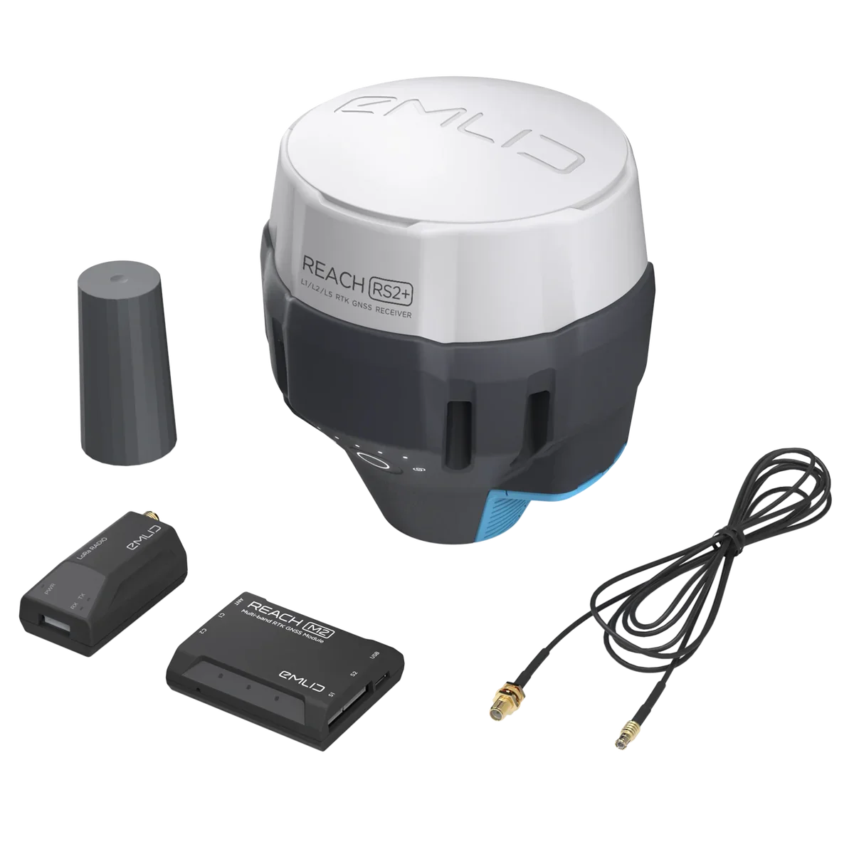
Emlid Reach RS2+ Multi-band RTK GNSS Receiver
The Emlid Reach RS2+ is a professional-grade multi-band RTK GNSS receiver designed to deliver centimeter-level positioning accuracy for surveying, mapping, construction, agriculture, drone operations, GIS data collection, and navigation applications. Combining advanced GNSS technology, long-range communications, and all-day battery life in a rugged, portable design, the Reach RS2+ provides reliable high-precision positioning in even the most challenging environments.
Supporting GPS, GLONASS, Galileo, BeiDou, and QZSS satellite constellations, the RS2+ delivers fast RTK fixes and dependable performance for both base and rover configurations. With integrated LoRa radio, Wi-Fi, Bluetooth, LTE connectivity support, and a user-friendly mobile application, it offers a complete solution for field professionals who require accurate positioning and efficient workflows.
Features
- Centimeter-level RTK positioning accuracy
- Multi-band GNSS receiver
- Supports GPS, GLONASS, Galileo, BeiDou, and QZSS
- Long-range LoRa radio communication
- Up to 8 km radio range
- Built-in Wi-Fi and Bluetooth connectivity
- LTE RTK rover capability
- Rugged field-ready design
- Mobile app for setup and operation
- USB Type-C charging
- LiFePO4 battery technology
- Compatible with surveying, mapping, drone, and GIS workflows
Multi-Band GNSS Performance
The Reach RS2+ tracks multiple satellite constellations simultaneously, improving accuracy, reliability, and performance in difficult environments such as urban areas, forests, and rugged terrain.
Supported GNSS Signals
- GPS/QZSS: L1C/A, L2C
- GLONASS: L1OF, L2OF
- BeiDou: B1I, B2I
- Galileo: E1-B/C, E5b
By receiving signals from multiple constellations and frequencies, the RS2+ achieves fast initialization times and highly reliable RTK positioning.
Centimeter-Level Accuracy
The Reach RS2+ provides professional-grade positioning accuracy suitable for:
- Land surveying
- Construction layout
- Topographic mapping
- Drone surveying and photogrammetry
- Precision agriculture
- GIS data collection
- Machine guidance and navigation
Its advanced RTK capabilities allow users to achieve precise measurements with confidence.
Long-Range LoRa Radio
Built-in LoRa radio technology enables reliable communication between base and rover units without requiring cellular coverage.
Radio Specifications
- Frequency: 868 MHz / 915 MHz
- Communication Range: Up to 8 km (5 miles)
- Reliable RTK corrections transmission
- Ideal for remote field operations
This allows survey teams to work efficiently in areas with limited network connectivity.
All-Day Battery Performance
The integrated LiFePO4 battery provides extended field operation while supporting flexible charging options.
Power System
- Up to 16 hours as an LTE RTK rover
- LiFePO4 battery technology
- 6–40V external power input
- USB Type-C charging
- Designed for full-day field use
The robust battery system ensures uninterrupted productivity during demanding projects.
Wireless Connectivity
The Reach RS2+ offers multiple connectivity options for seamless integration with mobile devices, controllers, and field software.
Connectivity Options
- Wi-Fi
- Bluetooth
- USB Type-C
- LTE RTK Rover Support
- Long-range LoRa Radio
These communication options provide flexibility for a wide range of workflows and field environments.
Mobile App Integration
The included mobile application simplifies setup, configuration, and operation of the receiver.
Benefits include:
- Easy base and rover setup
- Coordinate system management
- Data collection workflows
- Real-time status monitoring
- Survey project management
- Quick field deployment
Rugged Field-Ready Design
Built for professional use, the Reach RS2+ is engineered to withstand demanding outdoor conditions while maintaining consistent performance and reliability.
Ideal Applications
- Land Surveying
- Construction and Site Layout
- GIS Data Collection
- Precision Agriculture
- Drone Mapping and Photogrammetry
- Utility Mapping
- Environmental Monitoring
- Infrastructure Inspection
- Navigation and Positioning
Key Advantages
- Centimeter-level positioning accuracy
- Multi-constellation, multi-frequency GNSS support
- Long-range LoRa communication up to 8 km
- Up to 16 hours of operation on a single charge
- Wi-Fi, Bluetooth, and USB-C connectivity
- Lightweight and portable field design
- Easy-to-use mobile application
- Reliable performance in challenging environments
The Emlid Reach RS2+ Multi-band RTK GNSS Receiver delivers the precision, reliability, and flexibility professionals need for high-accuracy surveying, mapping, navigation, and geospatial applications in the field.





Reviews
Clear filtersThere are no reviews yet.